Map Library
-
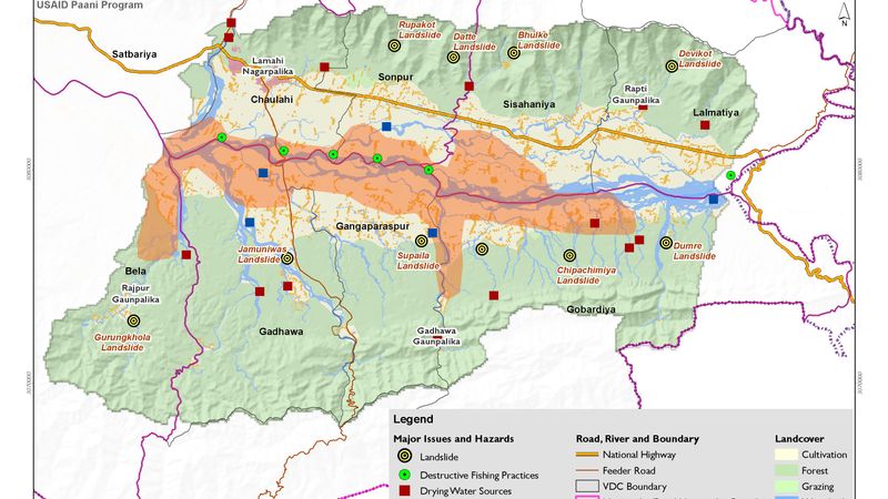
Major Flood, Landslide and Hazard Area
-
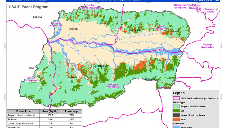
Forest Cover and Types
-
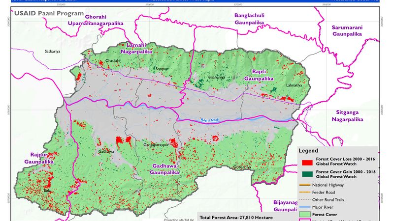
Forest Cover Loss and Gain between year 2000 to 2016
-

Gravel and Mining Operator
-
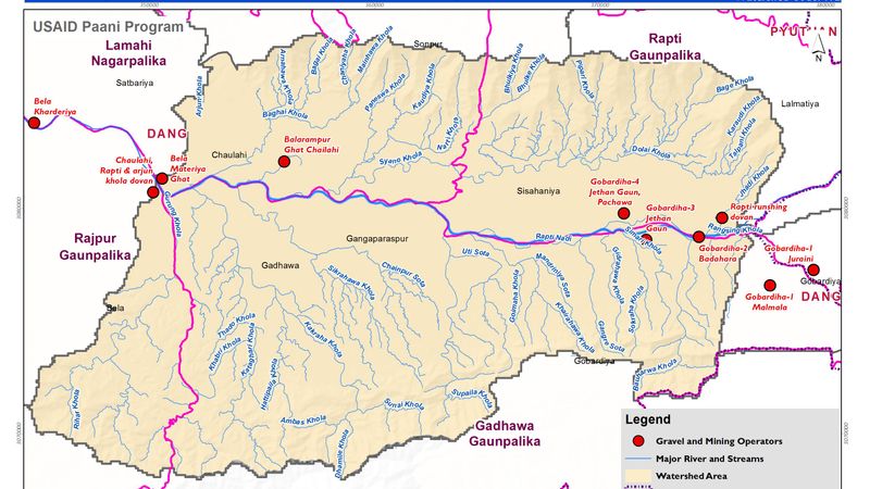
Gravel and Mining Operator
-
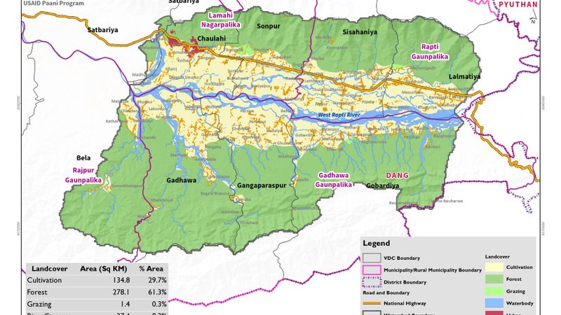
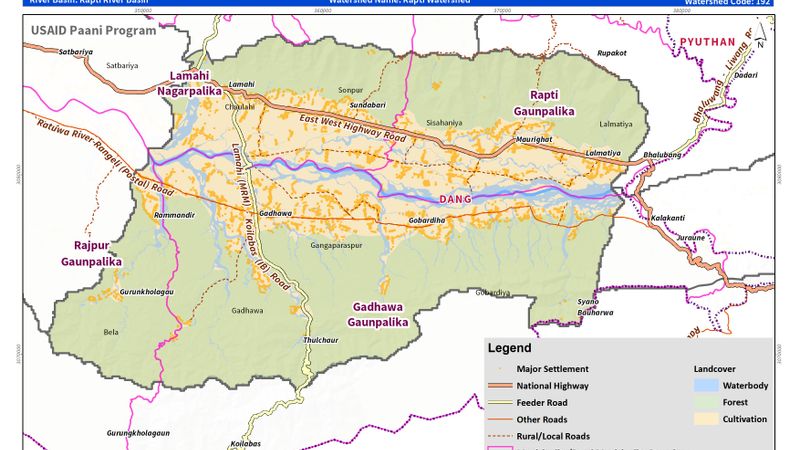
Landcover Map
-
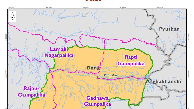
Location Map
-
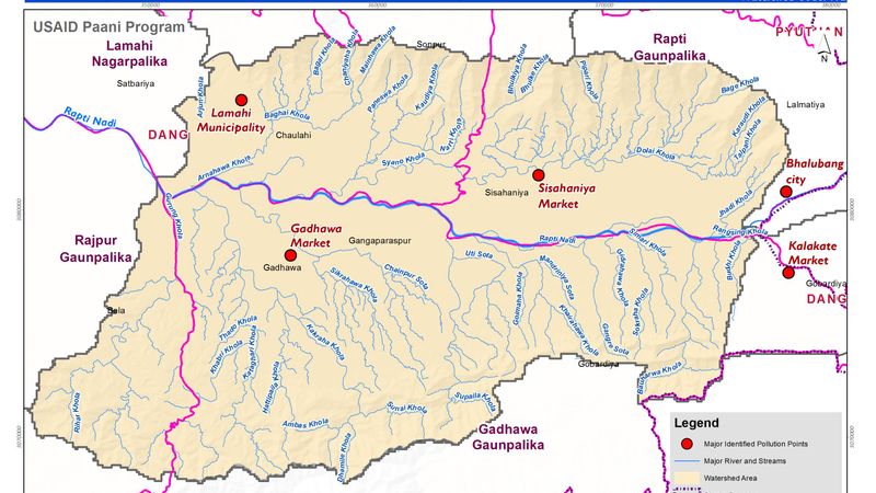
Major Pollution Points
-
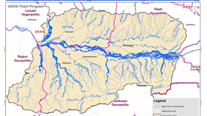
River Systems
-
Major Roads